

Community
Wild weather possible for Saturday night into Monday
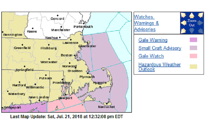
According to the National Weather Service, a Hazardous Weather Outlook has been issued for Massachusetts, Rhode Island, and Connecticut. Gale Watches, Warnings, and Small Craft Advisories have also been issued at certain locations for ocean waters in the area.
Enjoy the pleasant dry weather today as it will turn wet & wild late tonight into Sunday with Thunderstorms containing torrential downpours & gusty winds. The weather will be turning tropical Sunday afternoon with oppressive humidity likely persisting into much of next week.
Saturday night into Sunday…
Tropical downpours after midnight and into Sunday will produce rainfall rates upwards of 1 to 2 inches per hour with storm total rainfall amounts of 1 to 3 inches, locally higher. There is the threat of flooding with heavy rain.

In addition, accompanying thunderstorms could be strong to severe. Threats of gusty winds and possibly even a brief spin up of a waterspout or tornado.
There could also be flash flooding.
While all of Southern New England is at risk, greatest concern is along a south to north line centered along and around the RI / CT border through the eastern half of MA.
The combination of wind and wave action could result in dangerous rip currents especially along south facing beaches Sunday, potentially lingering into Monday.


-

 Community6 years ago
National Shrine of La Salette Festival of Lights 2017 set to begin
-

 Community6 years ago
Massachusetts State Police looking for good home for retired dogs
-

 Crime6 years ago
Fall River ranked most dangerous city in Massachusetts according to report
-

 latest6 years ago
Durfee student allegedly overdoses on marijuana
-

 Community6 years ago
Video of Fall River Police goes viral
-

 Causes6 years ago
Missing Fall River woman found deceased
-

 Crime6 years ago
Fall River Police add names to most wanted list
-

 Causes6 years ago
Fall River teenager reported missing has been found